Lonely, wild mountain landscapes and rough coasts with wind-blown sheep – That’s how you imagine the north of Ireland? You are quite right!
Page Contents (click line to jump the text)
Intro
Most tourists are drawn to the west coast, and especially to the southwestern part of the Wild Atlantic Way. Completely understandable, because the southwest is beautiful – I also wrote an article about it. But the south is also a bit touristy.
In the north you will find less tourists and if you do, they are mostly Irish families. They know where it is beautiful on their island!
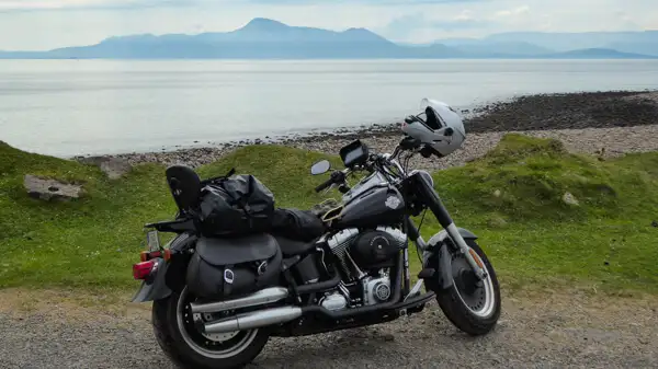
I know it too, because I was already much in the north of Ireland on the road. Mostly by motorcycle, but also by car – and hiking boots in the trunk.
We have our second home in Ireland and I have done a lot of hiking in the Wicklow Mountains and other places myself. But back to the topic…
The north offers a very pristine Ireland in many places. Beautiful landscapes and of course rough coasts. Sometimes also rougher weather than in the south, but that should not deter you – bring rain gear and enjoy the original Ireland!
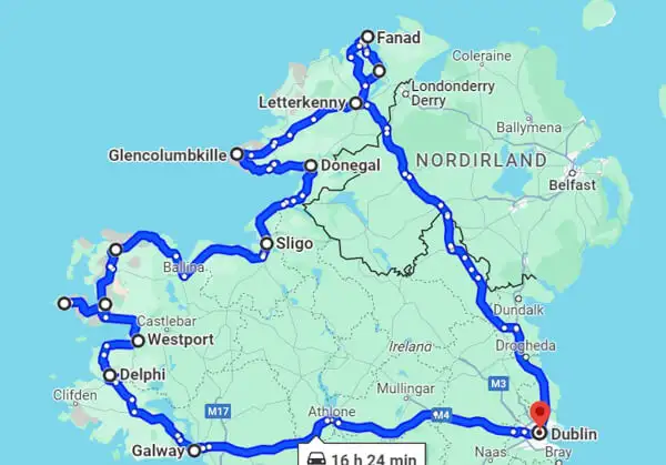
I have put together a virtual round trip with suggestions for day hikes for you to inspire you and to follow.
So, let’s get going:
Arrival: From Dublin to Galway
From Dublin you first drive to Galway. By the time you arrive in Dublin, get your rental car and leave the city, it will probably be noon or afternoon. By the time you get to Galway, it will be afternoon or evening.
If you want to do some walking there, I can offer the Salthill Promenade, which is a very long and beautiful promenade.
Tomorrow, after a hearty Irish Breakfast we can really get going.
Day 1: From Galway to Delphi
Many round-trippers and day-trippers are drawn from Galway first to Clifden and then to Kylemore Abbey. You can do that, but you don’t have to.
You can also visit the less visited Aughnanure Castle outside Oughterard. The small castle ruin is picturesquely hidden in the forest. The short tour in the main part of the castle is nice and the whole thing is not crowded.
Along the lakes you continue towards Leenaun.
For walking, I recommend any section of the Western Way Galway. This is one of more than 40 long-distance trails in Ireland, which leads you through the mountainous country of Connemara. One advantage: The routes of the long-distance trails are marked or signposted and therefore easy to find.
Especially beautiful are the sections between Maum and Leenaun, where you can walk away from the roads on the mountain.
On the very readable Irish blog www.toughsoles.ie you can find great hiking maps to download and print. Carl and Ellie have actually hiked all the long distance trails and have made great maps themselves. Here you can find the maps of the Western Way Galway.
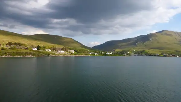
At Leenaun you reach Killary Fjord or Killary Harbour. This is the only fjord in Ireland and a scenic highlight. The county border runs through the middle of the fjord. On the southern shore you are in Connemara, respectively in County Galway, on the northern shore in County Mayo.
Shortly after Clog you can visit the Aasleagh Falls, several shallow waterfalls in a very beautiful landscape.
Overnight stay: In Delphi, Leenaun or surroundings.
Day 2: From Delphi to Westport
Mayo is less known than Connemara, but certainly just as beautiful! If you’re heading north of Killary Fjord, you’ll find several hiking options. You can also follow a long distance hiking trail again:
The Western Way Galway finds its extension to the north in the Western Way Mayo. There are also suitable maps from Tough Soles. I would choose the southern sections of the Western Way Mayo, see map sheets 18 and 19.
Alternatively, you can climb Croagh Patrick. The sacred mountain of the Irish is west of Westport. The entry point is at the village of Murrisk on the R335 coastal road.
The sugarloaf-shaped mountain is 764 meters high and has marked hiking trails. In places it can be steep and rolling, so bring sturdy shoes. Once at the top, you’ll be rewarded by spectacular views including the bay with its many islands and islets.
By the way, there is a second entrance on the back side of the mountain. If all this is too steep for you, there is also a hiking trail at the foot of the mountain, which is also very scenic.
Overnight: In Westport.
Day 3: From Westport to Sligo
Between Westport and Sligo, I have two recommendations for hiking for you:
First, you can go to Achill Island. The island is easily accessible via a bridge. The southern shore is especially nice to drive, because there you usually have a clear view of the great cliffs!
Be sure to drive all the way to the end to Keem Bay, the small bay framed by cliffs is a dream. Explore the island and you will find several nice options for a short or several hours hike. Some loop walks can be found here. By the way, I took the cover picture of this article on Achill Island.
Between Newport and Bangor there is a nature reserve, the Wild Nephin National Park. At the N59 you will find the Ballycroy Visitor Centre. There you will find information about hiking in the National Park.
The Western Way Mayo also runs through this region. Here you can find the maps from Tough Soles.
Overnight stay: In or near Sligo.
Day 4: From Sligo to Donegal
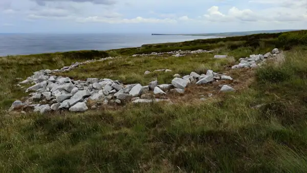
North of Sligo begins the table mountain massif of Ben Bulben or Benbulbin. At its foot you will find the lake Glencar Lough and there you will also find the small but pretty Glencar Waterfall. The valley is pretty, maybe you want to do some walking here?
You can also climb the mountain massif of Ben Bulben. Entrances can be found further back in the valley or on the back side of the massif, for example at Luke`s Bridge.
Alternatively you can walk on the Miner`s Way and Historical Way in several loops around the lakes Lough Key, Lough Arrow and Lough Allen. These are just a short distance south of Sligo. The Miner`s Way is not necessarily one of the most famous, but certainly one of the most beautiful long distance hiking trails in Ireland. You can choose a part of it and do a day hike along the beautiful lakes. Good maps of the Miner`s Way can be found here.
Overnight: In Donegal or nearby, for example in one of the nice B&Bs at Lough Eske.
Day 5: From Donegal to Glencolumbcille
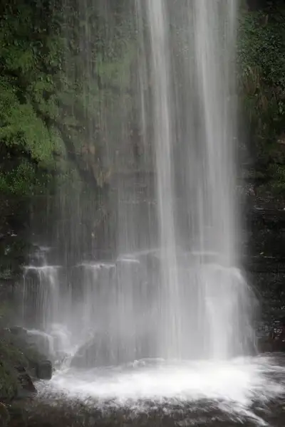
From Donegal it is only a short drive to Teelin. There you will already find signs to the cliffs of Slieve League and to Bunglasspoint, the lookout point there.
The cliffs of Slieve League are much less known than the Cliffs of Moher, although they are almost three times as high with up to 601 meters! In fact, they are among the highest cliffs in Europe.
And here, directly above the foaming sea, you can do several beautiful day hikes, such as the Pilgrims Path or the One Man`s Path. Information can be found at the Slieve League Cliff Centre in Teelin. Maps of the Slieve League Walks can be found at Alltrails – click here.
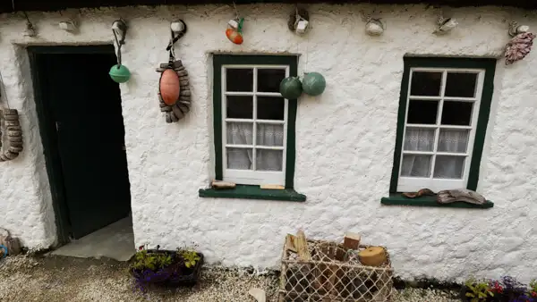
Continue on to Glencolumbcille and be sure to visit the lovely little Folk Village! It consists of a few cute cottages that show the life of ordinary people in the countryside over the centuries. There is also a small café and the village is nestled in a stunning natural setting!
Overnight: In Glencolumbcille or nearby.
Day 6: From Glencolumbcille to Letterkenny
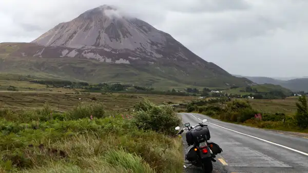
Today it’s off to the mountains of Glenveagh National Park. If you follow the R251 from Gweedore, you’ll pass a striking mountain:
Shaped like a sugarloaf, the rocky pointed mountain stands out among the otherwise green flat-topped peaks. This is Mount Errigal. It is 751 meters high and you can climb it in about 3-4 hours (there and back).
After that you can follow the road until you get to Glenveagh to the National Park Centre. There are hiking possibilities there as well.
A bit further you will come to the lake Lough Beagh. On its shore you will find the pretty Glenveagh Castle. From the parking lot you can walk about 30 minutes to the castle and admire the beautiful gardens and the wonderful location at the lake.
Overnight: For example in or near Letterkenny.
Day 7: From Letterkenny to Letterkenny (day trip)
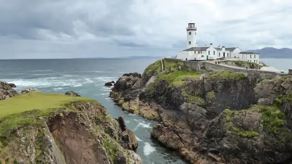
You simply have to see the Fanad Peninsula! Many tourists want to go to Malin Head because it is the northernmost point of the island, but I would prefer Fanad Head. Already the drive is wonderful and the lighthouse is really worth seeing!
Drive via Rathmullan and follow the coastal road R268 via Portsalon to Fanad Head.
Already at Ballymastoker Beach you can take a very long walk on the beach!
On the other side of the headland you will find White Shore Beach and several other beautiful sandy beaches. Enjoy the gorgeous shores and take advantage of every beach for a run.
Not far from Carrickart for example, there is another very long beach, Tramore Beach.
A little further on is the small dreamy Doe Castle in the bay. Let yourself drift along the coast and when you have had enough, you can spend a cozy evening in Letterkenny.
Overnight: Again in or near Letterkenny.
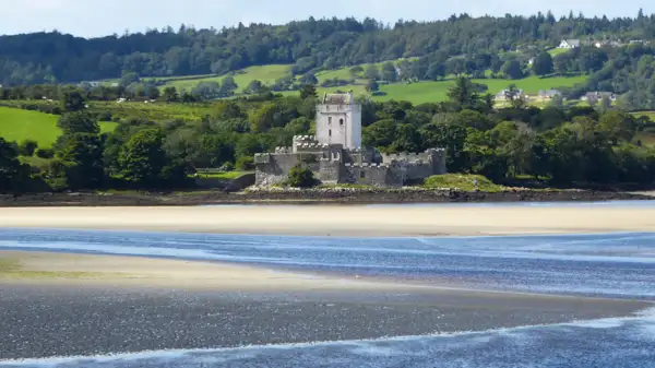
Day 8: From Letterkenny to Dublin
I’m afraid today we’re heading back towards Dublin. But actually not bad, because today also has its highlights:
For example, you can hike along Lough Erne. It’s in Northern Ireland, but the border is completely open, so no problem.
Carrick on Shannon is a nice, bustling, small town directly on the Shannon with many houseboats.
Also Mullingar is a nice little town, which invites for a lunch or coffee break.
You can walk a bit in the extensive park of the Belvedere House Gardens and Park at Lough Ennell.
And then you are back in the Irish capital, where you can enjoy good food and life music in the pub as a reward!
Overnight stay: In Dublin
Conclusion
The north of Ireland has its own charms. Is it different from the south? Yes.
Should you have seen without? Definitely!
Should you pack your walking shoes? Absolutely!!! (And don’t forget rain gear).
I hope I could inspire you a little bit to add the north of Ireland to your hiking wish list.
I wish you a wonderful trip!
More interesting articles for you
SOUTHERN IRELAND ROUND TRIP WITH DAY HIKES – 9 GREAT IDEAS FOR YOU
HIKING THE WICKLOW WAY – ALL INFO FOR YOUR VACATION PLANNING
HIKING WITH DOG IN IRELAND – ALL INFO FOR YOUR TRIP
Photo credits cover photo: Coastal scenery at Achill Island, photo by Ulrich Knüppel-Gertberg (www.irland-insider.de, www.ireland-insider.com)