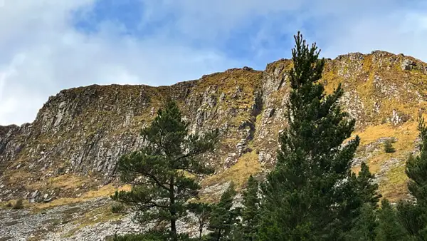
Of course, in Ireland the mountains are not comparable to the Alps, but nevertheless, even experienced mountain hikers can make fantastic tours and ascents here.
Page Contents (click line to jump the text)
Intro
The Irish modestly call it hillwalking, but they do distinguish between hills and mountains.
There are several lists of all the mountains in Ireland and it seems to be accepted practice that a mountain is at least 2000 feet high and the summit stands out from the surrounding area by at least 30 metres. According to the Irish Hewitt List, there are 209 mountain peaks on the island of Ireland, or 210 if you count a twin peak twice. I would like to introduce you to some particularly interesting mountains in this article.
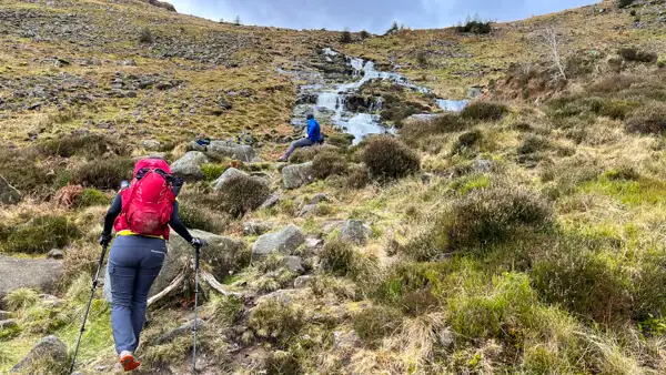
By the way, we live in Ireland (second home) and I have done a lot of hikes in the near Wicklow Mountains and other places as well. We have travelled the island again and again over many years and therefore know it very well.
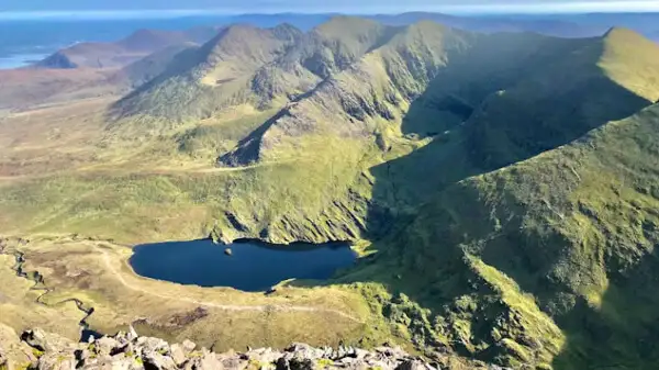
The Carrauntoohil
This is the highest mountain in Ireland at 1039m. It is located in the MacGillicuddy`s Reeks in County Kerry, where the highest mountains in Ireland are found.
The climb is considered rather difficult and strenuous. It should be taken seriously as there are several steep, scree and poorly marked sections.
Also, the mountains in Ireland are notorious for the fact that the weather can change very quickly and there can be very poor visibility at the top of the mountain. So you should start well equipped and prepared.
There are three main routes to the summit. The most popular is probably The Devil’s Ladder. Allow about 4-6 hours for this. Other routes include The Brother O Shea`s Gully Route, which takes around 6 hours, and The Caher Route, which takes around 6-8 hours.
See maps: https://hiiker.app/trails/ireland/county-kerry/carrauntoohil-via-devil-s-ladder.
Beenkeragh
Beenkeragh is the second highest mountain in Ireland at 1010m. It is in close proximity to Carrauntoohil. There is a circular route to the summit which can be estimated at around 6 hours. This route is also considered rather difficult and strenuous.
See maps: https://hiiker.app/trails/ireland/county-kerry/beenkeragh-and-stumpa-bharr-na-habhann-loop-via-caltramore.
Caher Mountain
At 1001m, Caher Mountain is the third highest mountain in Ireland. It is also in the immediate vicinity of Carrauntoohil, opposite Beenkeragh. There is a path to the summit, the Hydro Track, which should take about 5 hours. You should also take this climb seriously.
See maps: https://hiiker.app/trails/ireland/county-kerry/caher-carrauntoohil-and-cnoc-an-chuillinn-mountain.
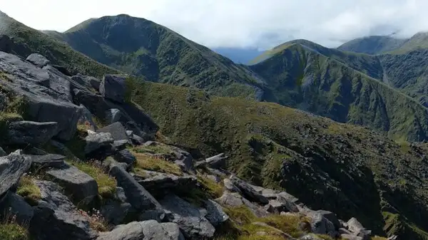
Cnoc na Péiste or Knocknapeasta
This is the fourth highest mountain in Ireland at 988m and is also close to Carrauntoohil. There is a very challenging route via Lough Googh where you also visit Big Gun (939m, (No.9 on the list) and Cruagh Mhór (932m, No.10 on the list). It goes over steep, and scree-like passages and steep ridges. So you need to be free from giddiness and experienced to do this route.
Siehe Karten: https://hiiker.app/trails/ireland/county-kerry/cnoc-na-peist-via-lough-googh-loop.
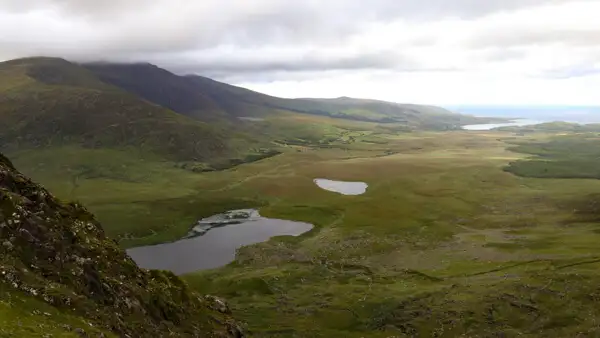
Brandon Mountain
At 952m, Brandon is the 8th highest mountain in Ireland. It is located on the beautiful Dingle Peninsula.
There are several routes up the mountain. The best known is probably the Saint’s Route, which is classified as moderately difficult. A little more difficult is the Faha Grotto route. It is about 9km round trip and takes about 7 hours.
It is not overly difficult but quite strenuous. On the other hand, if the weather is good, you will be rewarded at the summit with a fantastic panoramic view of the picturesque peninsula.
See maps: https://hiiker.app/trails/ireland/county-kerry/mount-brandon-trail.
Glencoaghan Horseshoe Walk
The Glencoaghan Horseshoe Walk is a strenuous 7-8 hour walk in County Connemara. It leads over 6 of the 12 Bens, as the mountain range is called. The peaks are Derryclare (677m), Bencorr (711m), Bencollaghduff (696m), Benbreen (691m), Bengower (664m) and Benlettery (577m).
None of them is extremely high, but in total there are over 1000 metres of altitude to climb on sometimes difficult terrain. Want to test your fitness? Then the Glencoaghan Horseshoe Walk is your tour!
See maps: https://hiiker.app/trails/ireland/county-galway/glencoghan-horseshoe-loop
Galtymore
At 918 metres, Galtymore Mountain is the highest mountain in Counties Tipperary and Limerick, as the county boundary runs across its ridge.
You can also reach its neighbouring peak, Galtybeg (799m), via this ridge – or vice versa. The Galtymore Hike is about 12km and takes about 4 hours. It is classified as medium-difficulty, but you should be well prepared and equipped for the hike to the summit.
By the way, it is one of the 14 highest mountains in Ireland, all of which are over 3000 feet high and thus called Munros.
See maps: https://hiiker.app/trails/ireland/county-tipperary/galtymore.
Lugnaquilla
The Lugnaquilla, or Lug as it is called by the locals, is situated in the Wicklow Mountains and with 925m height it is the 10th highest mountain in Ireland.
There are essentially 3 routes up the mountain which are not marked. There are passages where the paths are barely recognisable.
The climb, which takes about 6-8 hours (there and back), is definitely strenuous and is considered difficult because navigation can be challenging, especially in poor visibility. The Lug is notorious in Ireland for being very suddenly enveloped in cloud. So good preparation and good equipment is important.
See maps: https://hiiker.app/trails/ireland/county-wicklow/lugnaquilla-ridge-trail.
Conclusion
There are more mountains in Ireland that offer challenging hikes and climbs without being too extreme.
If you do a little research beforehand and perhaps pick up one of the good books/guides on the subject, you can easily put together a two-week tour of the island of Ireland and do a more challenging hike or climb practically every day.
Is there any better fitness training? Oh yes, in the evening after a successful summit tour, a cool Guiness in the pub is a must – it gives you the necessary energy for the next day! 😉
I wish you great and exciting climbs on Ireland’s Hills, Mountains and Munros!
More interesting articles for you
HILLWALKING IN IRELAND – TIPS ON CLOTHING AND EQUIPMENT
THE KERRY WAY
THE SHEEP`S HEAD WAY – HIKING ON THE SOUTHWEST COAST OF IRELAND
HILLWALKING IN IRELAND – THE MOST BEAUTIFUL ASCENTS FOR BEGINNERS
Photo credits cover photo: In the mountains of Beara, photo by Ulrich Knüppel-Gertberg (www.irland-insider.de, www.ireland-insider.com)