Malin Head is the northernmost point of the island of Ireland and therefore a popular destination for travellers. However, the journey there is much more beautiful, namely around the Inishowen Peninsula. The journey is the destination!
Page Contents (click line to jump the text)
Intro
The Inishowen Peninsula is located in the very north of the island of Ireland. It still belongs to County Donegal and therefore to the Republic of Ireland. However, it is also close to the city of Londonderry / Derry, which is located on the Northern Irish side of the green border.
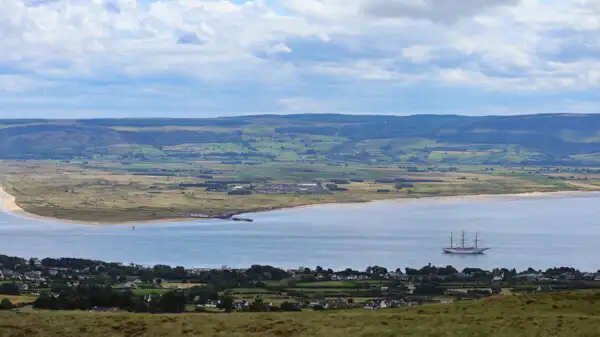
The peninsula stretches about 40 kilometres north-south and about 40 kilometres west-east. It is bordered to the west by Lough Swilly and to the east by Lough Foyle. The Irish word “lough” in this context does not mean a lake, but a bay. The wild Atlantic rages to the north. The highest wind speeds in Ireland are often measured here in winter, up to hurricane force.
I explored the peninsula on one of my motorbike tours, in beautiful weather with lots of sunshine and little wind. We come from Germany, but have lived in Ireland for several years (second home). We have travelled the island of Ireland several times and therefore know it quite well.
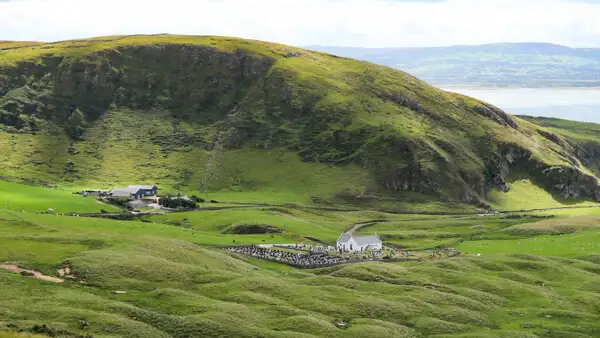
I really enjoyed my tour around the Inishowen Peninsula and would like to do it again when I get the chance. The peninsula is hilly inland, with the highest mountain being around 600 metres high.
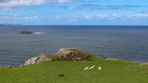
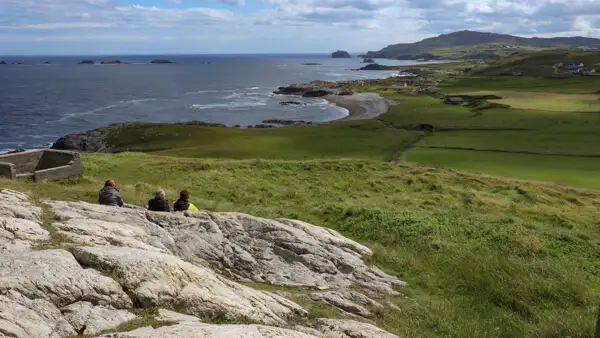
The west and east coasts offer marvellous views over the coasts and the two bays, and the roads often lead directly along the water. The north coast offers rugged cliffs and the open ocean, with a few offshore rocks and islets.
Malin Head
Malin Head is the northernmost point of the Inishowen Peninsula and the northernmost point of the island of Ireland. When I arrive there on my motorbike, my first impression is somewhat chaotic. The roads are very narrow and not very suitable for motorhomes.
This makes it all the more difficult for some of the tourists who try to park or turn around their much too large vehicle in the small car park. When they finally manage to do so, they look around the area somewhat perplexed, only to get back into their far too large motorhome and drive back along the small roads.
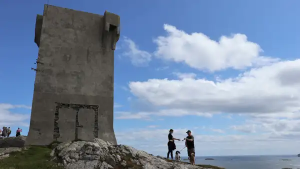
At first glance, Malin Head only offers an old dilapidated tower on a rock. This is the Signal Tower, a British lookout point and, during the Second World War, an Irish Army lookout point. Once you’ve had a look round, tick it off and drive on.
However, you can also take a nice walk around Malin Head from here. You can see one of the large EIRE signs made of light-coloured stones laid out on the ground. These were navigational aids for Allied pilots during the Second World War. They can be found on many of the island’s coasts.
The Stone Stacks and the Hell Hole can be found a little to the west. The coast is rocky and rugged and a short hike is a good idea.
The Inishowen 100 Drive
However, anyone who only “ticks off” Malin Head and drives straight back has, in my opinion, missed the most beautiful part. The magic of the peninsula is revealed on small and tiny roads: The Insihowen 100 Drive.
100 means 100 miles, or about 160 kilometres. That’s how far the round trip around the peninsula is. Of course, you can drive however you like and how it fits into your travel plans, but I can highly recommend this route. It is only partially signposted, but you can find a map here:
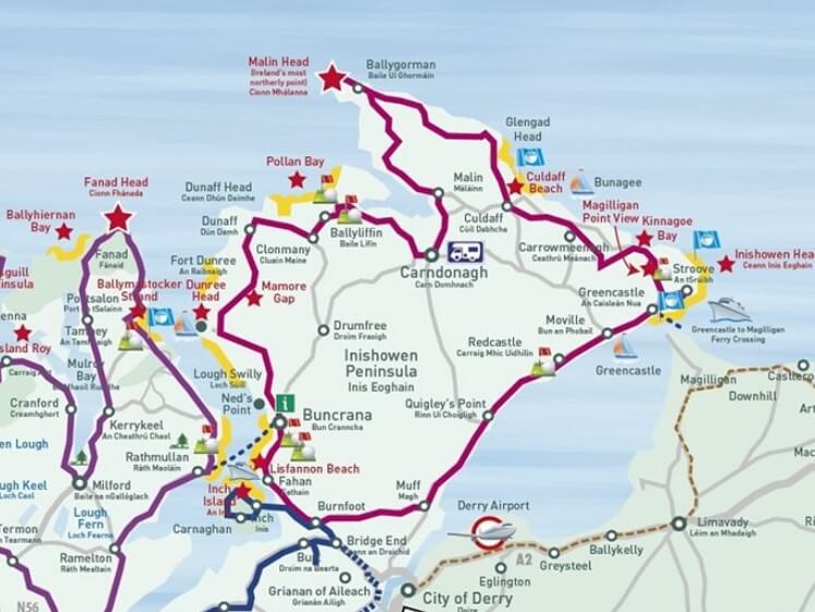
There are some beautiful viewpoints and a few small sights along the way, but the real highlight is the marvellous coastline and the small roads through the beautiful hills.
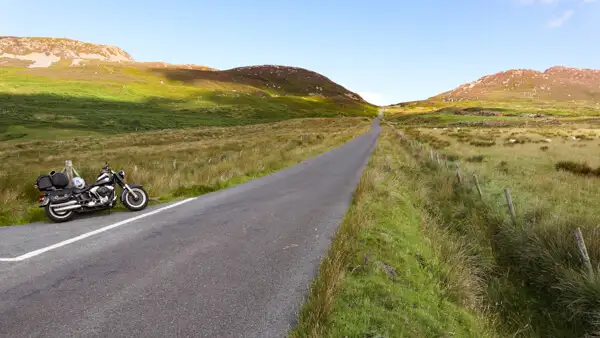
You will notice that there is little traffic here, much less than on the Causeway Coast in Northern Ireland, for example. In many places, the small roads are simply too narrow for coaches and excursion buses! But that doesn’t bother you on a hire motorbike or in a hire car, so you have the beautiful landscape partly to yourself.
You can find more information about the Inishowen 100 Drive here: https://www.govisitinishowen.com/itineraries/inishowen-100-drive/.
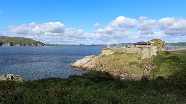
Fort Dunree
Fort Dunree is beautifully situated on the western shore of the Inishowen Peninsula and watches over Lough Swilly. There is a similar artillery bastion on the other side of the shore. Originally built during the Napoleonic Wars, the fort was refitted and recommissioned during the Second World War. Today it houses a small military museum. See: https://www.fortdunree.com/.
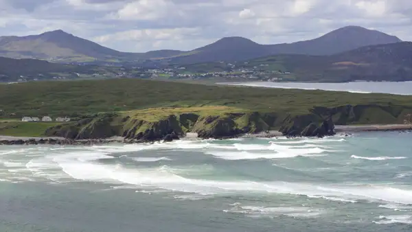
The Five Finger Beach
Five Finger Beach is one of the most famous beaches on the island. It is a very large sandy beach with sand dunes up to 30 metres high behind it. But the cliffs in front of the beach with the mountains in the background are also really worth seeing.
The Gap of Mamore
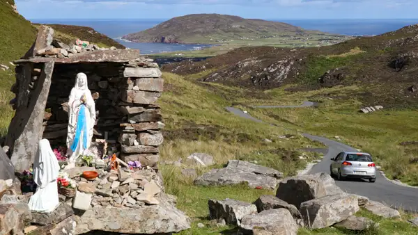
In the north-west of the island there is a ridge that runs parallel to the island. A small pass road, the Mamore Gap Road, crosses this ridge and leads over the Mamore Gap to Leenan. I can definitely recommend this drive! At the top of the pass you will find a small spring and a grotto, as well as a statue of the Virgin Mary. Behind it you can see the winding road snaking through the hills towards the coast – a marvellous view!
Other sights on Inishowen
There are a few other small sights, such as An Grianan of Aileach, a well-preserved ring fort, see: https://www.govisitinishowen.com/directory/an-grianan-of-aileach/.
Then there are several castle ruins on the peninsula, such as Carrickabraghy Castle near the Five Finger beach, see: https://www.govisitinishowen.com/directory/carrickabraghy-castle-2/.
And for fans of Neolithic sites, there is the Temple of Deen inland on the R238. The Bocan’s Stone Circle is on the same road opposite. See also: https://www.govisitinishowen.com/directory/temple-of-deen/.
Conclusion
The Inishowen Peninsula is well worth a visit! The round trip around the peninsula takes a day and can be combined very well with a double overnight stay in Londonderry / Derry.
From here you can continue eastwards and visit the Causeway Coast of Northern Ireland, or you can continue westwards and visit the beautiful Fanad Peninsula with the photogenic Fanad Head Lighthouse. I’ve already written an article about this, which I’ve linked for you below.
In any case, I hope you enjoy your trip to Malin Head, the northernmost point of the island!
More interesting articles for you
FANAD HEAD LIGHTHOUSE – IN THE FAR NORTH OF IRELAND
A WALK ON THE CITY WALLS OF DERRY / LONDONDERRY
THE WONDERFUL MOUNT STEWART HOUSE AND GARDENS
THE CLIFFS OF SLIEVE LEAGUE – MAJESTIC AND MARVELLOUS
Picture credits cover picture: Inishowen Peninsula, photo: Ulrich Knüppel-Gertberg (www.irland-insider.de, www.ireland-insider.com)