You’ve probably heard of Waterford as one of Ireland’s oldest cities, founded by the Vikings. But did you also know that County Waterford has beautiful coastlines and seaside towns?
Page Contents (click line to jump the text)
Intro
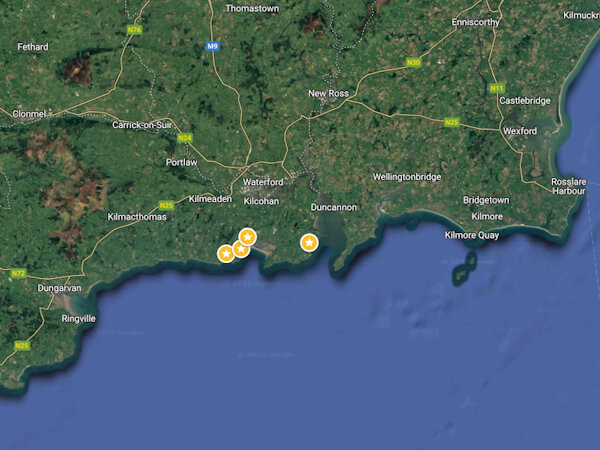
Just a few kilometres south of the city of Waterford are two pearls on the coast. Strictly speaking, they are coastal towns. One, Tramore, is a seaside resort and local holiday destination. The other, Dunmore East, is a fishing village.
Both are situated on a rocky coastline with rugged cliffs, small coves and large bays with beautiful sandy beaches. To the west is the Copper Coast, a UNESCO Global Geopark. To the east lies neighbouring County Wexford.
While County Wexford has kilometres of sandy beaches, County Waterford has some impressive cliffs to offer. Not as high as on the west coast, but still very beautiful cliff landscapes.
I’ve been to the Copper Coast several times and I know County Wexford and its coasts very well. But I only knew the beautiful towns of Tramore and Dungarvan from driving through them.
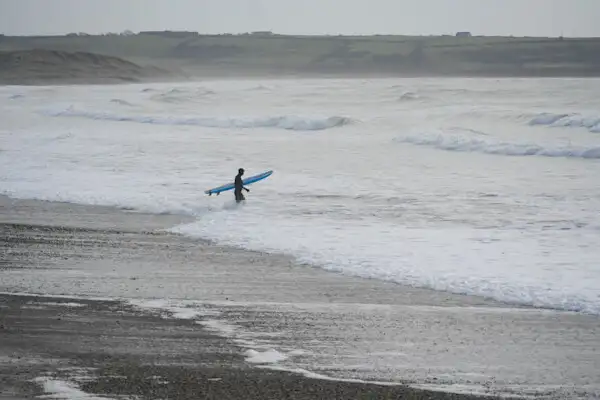
A short trip in February (2025) should change that. I mention February specifically because there were quite a few people swimming and surfing on the coast – in February. It was a mild and sunny day, but the water was still definitely ‘quite fresh’.
The surfers at least had wetsuits on to provide some protection from the cold water. But the swimmers were only dressed in swimming costumes – in February.
Did I mention that Waterford was founded by Vikings? That must be the genetic heritage…
The Fisherman’s town of Dunmore East
Dunmore East is only about 17 kilometres south-east of the city of Waterford and is easily accessible from there in half an hour’s drive.
The River Suir flows through the city of Waterford and Dunmore lies at its mouth into the sea. The estuary is so wide at this point that it could easily be mistaken for a large bay.
On the opposite shore, in County Wexford, lies the Hook Peninsula with the beautiful Hook Lighthouse, which can be easily recognised in the distance.
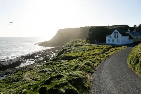
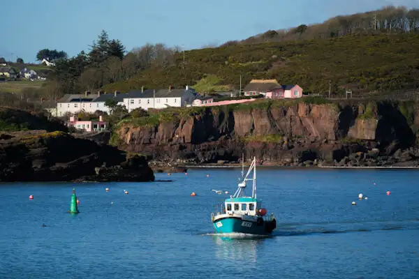
The small village nestles against and between the hills, which extend into the sea as rugged brown cliffs. Small houses, a small beach, a few shops and a large fishing harbour one bay away. That’s Dunmore all right.
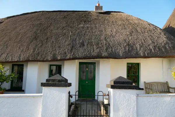
Speaking of houses, some of them are small, crouching, sloping cottages with reed roofs. They must be old fishermen’s cottages – marvellous.
Otherwise, you mainly see bungalows of all ages, strung across the hills like a string of pearls.
I really like the harbour. Not by chance, I like boats and I like small harbours.
A large car park above the harbour is tempting because it’s right on the upper edge of the cliffs. What a view, even as you get out of the car!
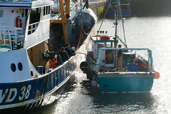
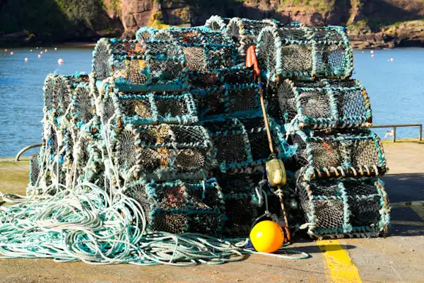
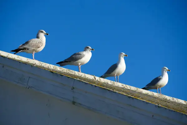
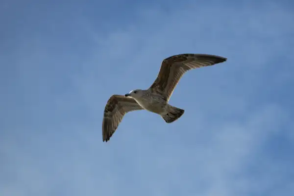
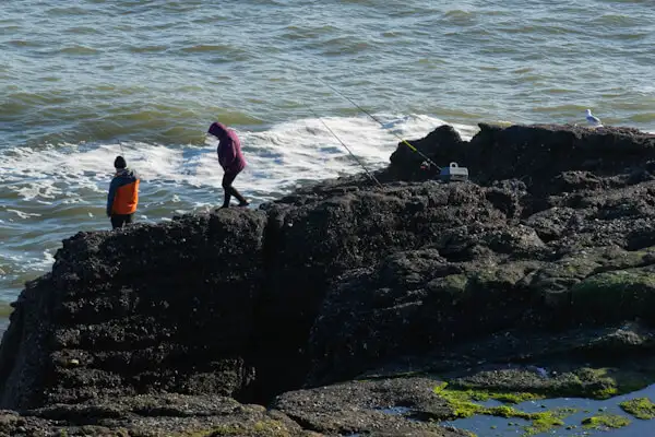
Seagulls circle over the cliffs and the harbour and I walk down the steps to the boats and ships. This is a working harbour. You can walk along the long pier to the lighthouse and back through the harbour. Small fishing boats, large fishing boats, nets and traps and hustle and bustle.
It’s almost nothing anymore, a man working on equipment tells me. There used to be a lot more boats here, but now many fishermen have given up. This is not because of the fish, of which there is plenty, but because of the limited EU quotas off Ireland’s coast, which the Irish have to share with the English, French and Spanish.
Only 12% of the fishing quotas off Ireland’s coasts are available to Irish fishermen. The blame lies with the government, which doesn’t care about the fishermen and doesn’t want any stress with the EU.
The two fish factories in the harbour were unfortunately closed years ago. If you add together the boat crews and the factory employees who can no longer work here, then around 150 jobs have been lost here in the last 10 years (or so). That’s 150 families affected – painful for such a small place.
The man is very friendly and tells me a lot about fishing, the different fish and which ones taste best. He is proud of his profession and I can really understand his enthusiasm for it.
Two small fishing boats enter the harbour one after the other. In the background I can see the brown cliffs and the small houses on the hills. Seagulls sit on the wall and enjoy the sun.
‘A beautiful picture – and what an interesting excursion!’ I think and drive the few kilometres further to Tramore.
The sea resort of Tramore
Tramore is only about 12 kilometres or a 25-minute drive south of the city of Waterford. It is also only a few kilometres from Dunmore East.
The impression could not be more contrasting to Dunmore East, as Tramore is clearly a seaside resort that caters for visitors. See also: https://visitwaterford.com/category/explore/tramore/.
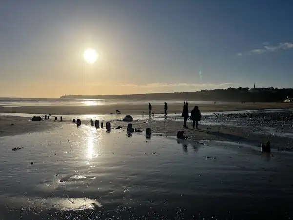
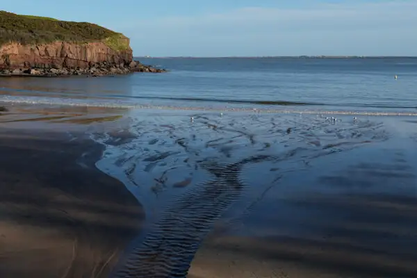
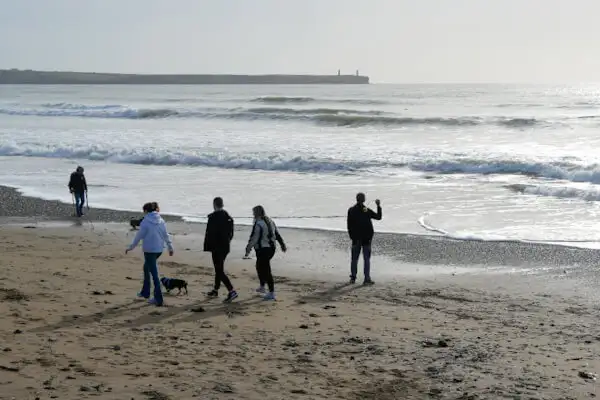
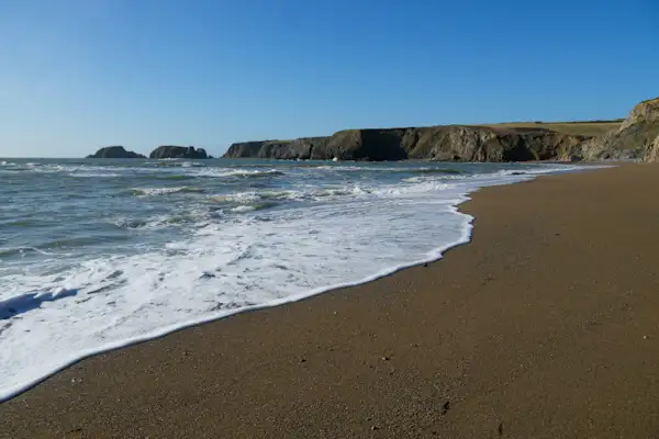
The very long beach promenade is particularly beautiful. It is wonderful for strolling along the water. On one side is the town centre and on the other is the beach and the dunes.
These are located on a long sandy headland that extends into the sandy delta of a small river. On the land side of this sand spit are alluvial meadows where hundreds of birds rest and search for food. On the sea side, the surf rolls onto the beach.
And how it rolls! It’s probably high tide now in the morning and there’s no sign of the beach in front of the promenade. The spray is even splashing over the wall onto the promenade.
I’m here again in the afternoon. In the meantime, the wind has died down and it’s low tide. There is now a wide, beautiful sandy beach where families with children and dogs are having fun. It’s a weekday and there are a surprising number of people on the beach.
People sit inside and outside in the cafés and watch the surfers walking back and forth from the surf shops with their boards – and surfing in the surf.
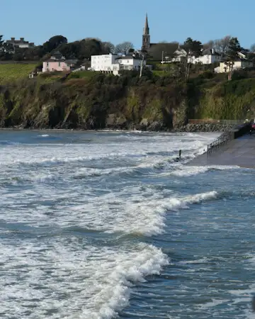
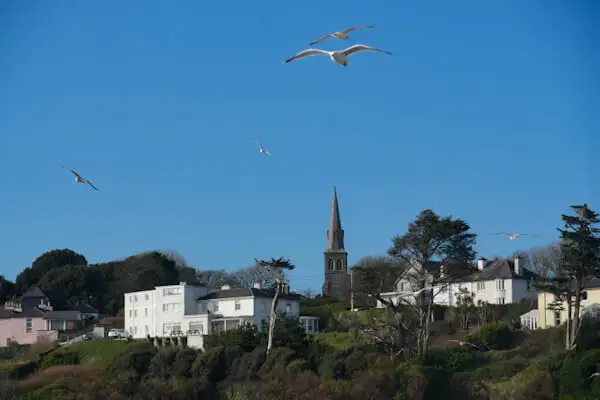
The town can be seen in the background. Not necessarily a beauty, but oh well. The view from the other side is much more interesting: A church with a few houses rises high above the village and the cliffs in front of it drop steeply into the sea. A great residential area!
I follow the coast and the cliffs a little further on…
Newtown Cove Swimming Beach
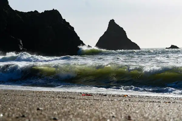
The bay of Tramore is lined with steep cliffs. High towers stand on both headlands. They are not lighthouses. There are two to the east and here, on the west side, there are three. One of them has a huge silver statue made of steel on top. This is the Metal Man looking out to sea.
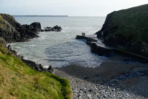
There is a small cove below. A cove is a very narrow and small bay between rocks. Usually covered with a shingle or sandy beach, coves used to offer small boats the opportunity to land between the rocks.
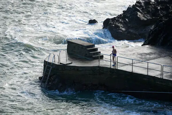
Newtown Cove has another story. I haven’t read it in full, but a bathing facility was probably created here as early as the 19th century. Long steps lead down into the cove and there are entrances for swimming, which are equipped with ladders and ramps.
There are two of them, because back then men and women bathed separately!
Today, on this day, there are actually women bathing at these two entrances, dressed only in swimming costumes – in February….
The sea is anything but calm, the surf is foaming and you can see whirlpools further out. But the ladies obviously know exactly what they’re doing.
Garrarus Beach at the Copper Coast
The Copper Coast begins a few kilometres further on. The exact boundaries are not entirely clear to me, but on the UNESCO Global Geopark website, Garrarus Beach is already listed as a Geopark site.
I have travelled along the Copper Coast several times. There are old copper mines on the cliffs here, some of whose shafts were dug under the sea. This is where the coast got its name. Mining has long since ceased, but you can find out about it in the centre of the geopark, in Bunmahon. See: https://coppercoastgeopark.com.
But the coastline between Tramore and Dungarvan is one thing above all else: fantastically beautiful! The small coastal road winds its way through the hills. Again and again you can see vertical cliffs interrupted by small sandy coves. A marvellous drive!
The first large sandy beach on the way west (to Tramore) is Garrarus Beach. You have to know that you want to go there, otherwise you can easily drive past the access road.
The car park is well paved and after a few metres you are standing on fine, dark yellow sand. Almost black cliffs frame the beach and give it an almost mystical appearance.
This impression is further emphasised by several black rock needles and small rock islands scattered off the coast.
An almost unreal and very special beach that you should definitely see!
The next beach, Kilfarrasy Beach, is also great. I already know it from previous trips. My time window is dwindling and I make my way back to Tramore.
Conclusion
‘Hidden gems’ is what they call hidden gems in Ireland, or hidden beautiful places. And that’s exactly what they are, the small villages, the Black Cliffs, the hidden coves and the beautiful sandy beaches in the south of Waterford.
If you visit the city of Waterford, take time to explore the famous Viking Triangle at the harbour. And then plan another day to explore these beautiful coasts at your leisure. It’s worth it – I promise!
More interesting articles for you
WATERFORD AND THE VIKINGS
THE PICTURESQUE COPPER COAST
HOOK HEAD LIGHTHOUSE – THE OLDEST ACTIVE LIGHTHOUSE IN THE WORLD
A HISTORICAL ROUND TRIP IN IRELAND’S ANCIENT EAST
Cover picture: On the beach promenade in Tramore (Photo: Ulrich Knüppel-Gertberg)