You want to go hiking in Ireland, but you don’t know where to go? The southwest is always a good recommendation – I’ve never met anyone who didn’t love it there!
Page Contents (click line to jump the text)
Intro
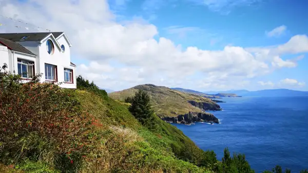
If you take a look at the map, you will find several peninsulas in the south-west of the island of Ireland, which stretch out into the sea like the fingers of a hand. They usually have a more or less high mountain ridge inland and become flatter towards the coast.
The coasts are very varied, alternating steep cliffs with high surf and white sandy beaches with crystal clear water.
So it’s no wonder that hikers feel particularly at home in this landscape. I will introduce you to some beautiful hiking trails below.
By the way, we live in Ireland (second home) and I have done a lot of hiking in the Wicklow Mountains and other places. We have travelled the island again and again over many years and therefore know it very well.
The Sheep`s Head Way
The Sheep’s Head Peninsula is much smaller and less well-known than its bigger sisters Beara, Dingle or Iveragh (Ring of Kerry). This makes it all the less touristy. Also, the ridge inland is less steep and less high than on the other peninsulas.
This makes the Sheep’s Head Way a little easier to walk. But that does not mean it is boring, quite the opposite. The circular walk is about 175km long and starts and ends in Bantry. It runs in a long loop across the whole Peninsula and you can of course do any part of it as a day walk.
The northern route runs along the ridge and offers fantastic long-distance views in good weather. The southern part of the route runs a little lower and is therefore recommended in not so good weather.
This southern part is also beautiful to walk, especially at the end of the peninsula, where you walk along low cliffs right next to the water. There is also a small lighthouse hidden away. So Sheep Head is a hidden gem among the peninsulas of the southwest.
Find great maps here: http://maps.toughsoles.ie/dist-maps/latest/Sheep%27s%20Head%20Way.pdf.
The Beara Way
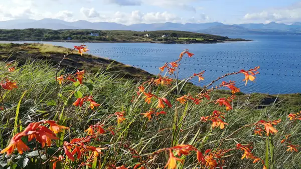
The Beara Peninsula is a little better known, but still less visited than Killarney or Dingle. It is larger than Sheep’s Head and the mountains in the interior of the peninsula are considerably higher.
The Beara Way is one of the better-known long-distance hiking trails in Ireland and is also often offered as an organised tour. It runs in a big loop over 150-210km across the peninsula and starts and ends in Kenmare.
The trail runs along the mountainside for long stretches, with some small road sections and forest tracks. The ground is mostly hard and rocky and sturdy footwear is highly recommended. The good side of the rocky ground is that it doesn’t get too muddy in wetter weather.
There is also some elevation gain on the Beara Way and so it is more recommended for more experienced walkers with good fitness. As always, you can also walk individual sections from several towns on the peninsula as a day trip or make it a shorter version lasting several days.
A special treat is Dursey Island, a small offshore island at the tip of Beara. There you will find the Dursey Cable Car, the only cable car in Ireland, with which you can cross over to the island and do a day hike there.
See maps: http://maps.toughsoles.ie/dist-maps/latest/Beara%20Way.pdf.
The Dingle Way
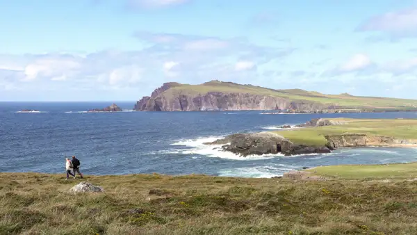
The Dingle Way is one of the best known long-distance walking routes in Ireland. Dingle is a beautiful peninsula north of Killarney. However, it is also very busy in summer. You should therefore book accommodation in advance.
The Dingle Way is a circular route. It starts and ends in Tralee and the total distance is about 180km. If you like it shorter, you can start on the Peninsula and walk about half of the trail. The trail is easy to walk as it mostly runs along the coast and only one stage of the day is a little steeper in the mountains.
See maps: http://maps.toughsoles.ie/dist-maps/latest/Dingle%20Way%20-%20Sli%20Chorca%20Dhuibhne.pdf.
The Kerry Way
If the Dingle Way is too easy for you, you can “let off steam” on the Kerry Way. The start and end points are in Killarney, with over 200km to cover in between.
It goes through the beautiful Killarney National Park and along some of the highest mountains in Ireland.
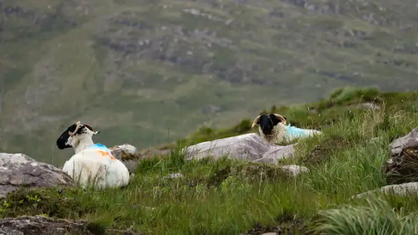
You don’t have to climb them, but the trail still has its metres in altitude and, over long stretches, rather difficult surfaces such as rock, gravel and scree, or “lush” bog, i.e. wet high moorland. You also get deeper at the tip of the Peninsula and onto the coast.
As always, you can choose to do a section as a day hike – or several.
See maps: http://maps.toughsoles.ie/dist-maps/latest/Kerry%20Way.pdf.
Day walks in Killarney National Park
Killarney National Park is a beautiful low mountain range with many wonderful walks.
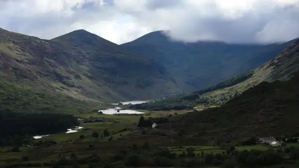
You can hike to Torc Waterfall, for example, or climb up the beautiful Valley of Dunloe and cross over to the Black Valley on the other side. If you rent a car in Killarney and ask at the tourist information, you will get many suggestions for beautiful day trips.
See also: https://www.nationalparks.ie/killarney/.
On the Burren
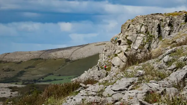
The Burren is a unique karst landscape on the coast south of Galway. The undulating cliffs are protected and are home to a unique flora and fauna that has adapted well to the barren conditions here.
Beneath the rock are some extensive stalactite caves that you can visit, such as Ailwee Cave. And up on the hills there are prehistoric sites that are over 5000 years old, such as Poulnabrone Dolmen, which is probably one of the best preserved dolmens in Ireland.
There is a long distance footpath of over 100km across the Burren. The most beautiful sites are certainly on the coast at Fanore and in the karst mountains between Fanore and Ballyvaughan.
See also: https://www.nationalparks.ie/burren/.
At the Cliffs of Moher
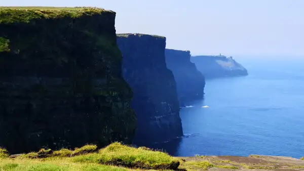
The Cliffs of Moher are one of Ireland’s most important and most visited attractions – and rightly so, for they are truly incredible. Almost perpendicular, the mighty cliffs rise vertically from the sea. Thousands of seabirds nest in the rocky outcrops and you will see many of them.
The Cliffs of Moher Visitor Centre is also a very touristy place in the summer. Busloads of tourists arrive here daily to admire the spectacular cliffs.
If you want to enjoy this beautiful landscape a little more intimately, then walk from Liscannor to Moher Tower at Hag`s Head and follow the narrow cliff path north past the Visitor Centre to Doolin. The route is about 20km long and runs directly along the cliff edge for many kilometres. North and south of the Visitor Centre you will have the beautiful cliffs practically to yourself for several kilometres!
See also: https://www.cliffsofmoher.ie/your-visit/beyond-the-cliffs-places-to-see/cliffs-of-moher-coastal-walk/.
Conclusion
The southwest of Ireland offers the hiker an enormous choice for wonderful tours. The peninsulas of Sheep`s Head, Beara or Dingle are simply gorgeous, as are the other peninsulas in the region!
Killarney National Park also offers the most beautiful mountains and the most beautiful, albeit more strenuous, treks and trails. In addition, the weather in the south is usually a bit warmer than in the north.
However, other tourists know this too, so Killarney or the Cliffs of Moher can get quite “busy” in summer. But don’t let that put you off, if you walk a bit, you’ll have the beautiful scenery almost to yourself!
I wish you wonderful walks in the southwest of Ireland!
More interesting articles for you
THE MOST BEAUTIFUL HIKES IN IRELAND’S SOUTHEAST
HIKING AND WILD CAMPING IN IRELAND – IMPORTANT TIPS!
THE MOST BEAUTIFUL HIKES IN IRELAND’S NORTHWEST
Photo credits cover photo: Coast at Beara Peninsula, photo by Ulrich Knüppel-Gertberg (www.irland-insider.de, www.ireland-insider.com)