The Dingle Peninsula is a must-see on your tour along the southern Wild Atlantic Way. Breathtaking coastlines, prehistoric finds, a surfer’s paradise and a beautiful mountain pass await you here…
Page Contents (click line to jump the text)
Over the Conor Pass to Dingle Harbour
If you are driving to Dingle from Tralee, you will probably use the N86. At Camp turn right onto the smaller R560.
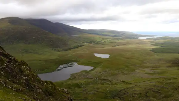
This takes you in an arc along the coast and then towards the mountains, which you can see from a distance. The small road leads uphill and becomes narrower and narrower. To your left, ridges rise and to your right you see an elongated valley.
The vegetation becomes sparser and the slopes rocky. Soon you reach the viewpoint at Conor Pass. At 456 metres, it is the second highest pass in Ireland.
In both directions you can see the sea, behind you the north coast of the Dingle Peninsula Dingle and in front of you you can already see the small harbour town of Dingle with the same name.
A few long curves lead from the top of the pass down into the valley and to Dingle. The pretty town is worth a stop and also offers opportunities for a small coffee or snack.
A lot of history on Dingle
People settled in this region more than 5000 years ago. Several archaeological finds, such as ring forts and dolmens, bear witness to this today. On the way to Slea Head, you will pass the prehistoric museum, where you can learn about Ireland’s early history.
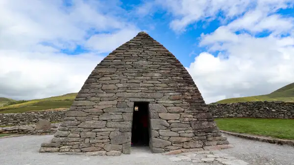
In the Middle Ages, monks settled here and built very modest stone shelters. You can also visit the round stone huts, called beehive huts, on the way to Slea Head. The Gallarus Oratory was also built by monks.
And then there are Famine Cottages: when the potato crops were affected by rot in the middle of the 19th century, the population starved terribly – this was the Great Famine.
Millions of Irish people left their cottages and sailed to North America on sailing ships in the hope of a better life. In many places in Ireland you can still find the abandoned cottages and entire empty settlements from this time.
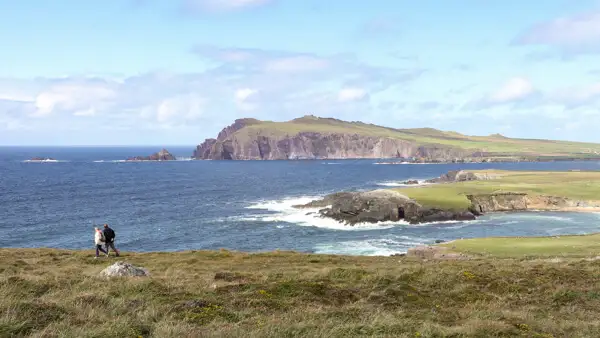
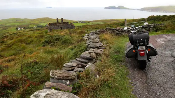
The Slea Head Drive
The R559 from Dingle to the outermost tip of the island, Slea Head, is called Slea Head Drive. You must enjoy this little road at your leisure. Stop now and then and look back, the coast is absolutely worth seeing in both directions.
Shortly after Slea Head you will see rocky islands off the coast to your left, these are the Blasket Islands.
A little further on the left is Cilmenoole Beach and a little further on Dunquin Pier.
It’s worth stopping and taking a look.
You can drive back to Dingle in a big curve via Gallarus Oratory. From there, follow the N86 to Inch Beach.
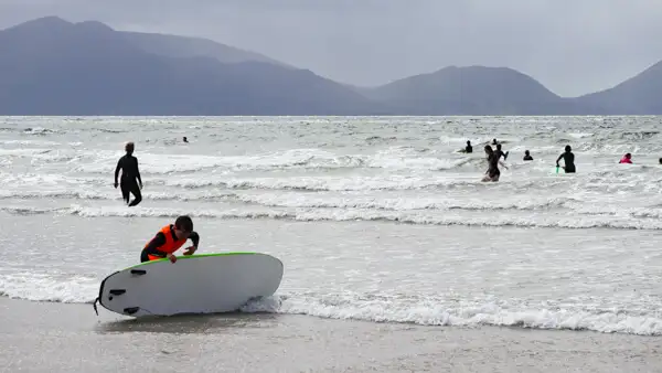
Surfers on Inch Beach
You can drive back to Dingle via Gallarus Oratory. From there, follow the N86 to Inch Beach.
Inch Beach is a long sandy beach in the bay of Castlemaine Harbour.
The beach is well worth a short walk. It is a popular spot for surfers who enjoy the waves of the bay.
So much sport makes you hungry just watching! Afterwards, you can relax and recharge your batteries at the surfers’ café near the road.
Portmagee and the Skellig Islands
You continue to Killorglin and follow the N70 – the famous Ring of Kerry, which leads around the Iveragh Peninsula. At Portmagee you reach “Starwars” country. This is where the Star Wars film crew spent several months filming The Force Awakens and The Last Jedi.
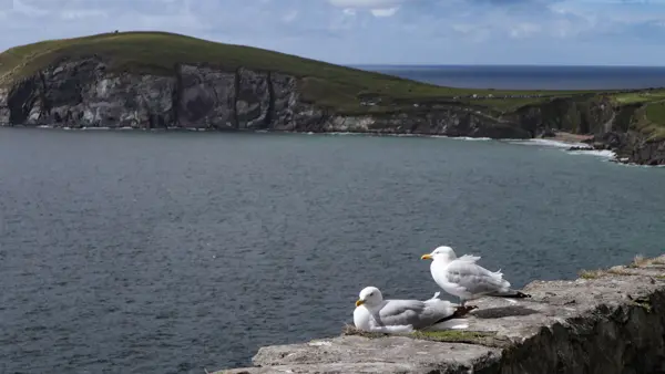
From Portmagee you can take small boats over to the Skellig Islands. Skellig means rocky needle, and that’s what the rugged islands look like.
The Skelligs are breeding grounds for numerous seabirds. On Skellig Michael you can see puffins in summer – funny puffins with colourful beaks.
There are also the remains of a medieval monastery with beehive huts – stone round huts very similar to those on Dingle.
This was also the retreat of Luke Skywalker in the film “The Last Jedi!
Over the Kerry Cliffs to Kenmare or Killarney
You should definitely visit the Kerry Cliffs. They are less high than the Cliffs of Moher, but very beautiful to see.
Continuing along the Ring of Kerry, you will soon reach Killarney or the harbour town of Kenmare.
Outlook
In the next episode, we will go to the beautiful Beara Peninsula – you can be curious.
More interesting articles for you
IRELANDS WILD ATLANTIC WAY – PART 8 – THE BEARA PENINSULA
IRELANDS WILD ATLANTIC WAY – PART 9 – MIZEN HEAD AND BALTIMORE
IRELAND’S WILD ATLANTIC WAY – PART 1 – AN INTRODUCTION TO THE WORLD’S LONGEST COASTAL ROAD
VIKINGS – A TOUR IN THE FOOTSTEPS OF THE HIT SERIES – AND THE VIKING HERITAGE OF IRELAND
Photo credits cover photo: Southern coast of Dingle Peninsula, photo by Ulrich Knüppel-Gertberg (www.irland-insider.de, www.ireland-insider.com)