The North West is a paradise for hikers and hillwalkers. There are very diverse landscapes: mesas, ranges of hills, boggy hilltops, rocky cliffs and steep peaks invite you to exciting discovery tours.
Page Contents (click line to jump the text)
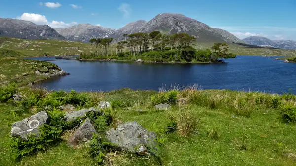
Intro
The hikes are as varied as the landscapes. Today you can follow a forest path along a stream, tomorrow you can take a cliff walk and the day after tomorrow you can climb a mountain.
The range of beautiful walks in the North West of Ireland is very impressive. I would like to introduce you to some of these possibilities in this article.
By the way, we live in Ireland (second home) and have done a lot of hiking in the Wicklow Mountains and other places. We have travelled the island again and again over many years and therefore know it very well.
The Croagh Patrick Heritage Trail
St. Patrick is an enormously important figure in Irish history. It is not for nothing that St. Patrick’s Day is fiercely celebrated every year and every year thousands of pilgrims climb the steep sugar loaf of the holy mountain Croagh Patrick.
This is not about climbing the peak, but walking the historic paths of St. Patrick:
There is a marked walking route from Balla to Murrisk, at the foot of the mountain. Along its path are several historical sites, including the beautiful monastic ruins of Ballintubber. The trail stretches over 60km and you can walk it in 3 day stages.
If that’s too much for you, you can walk just the last few kilometres. You approach Clew Bay with its hundreds of islands from the east and walk along the foot of the sacred mountain to Murrisk, the starting point of the pilgrimage trail to the summit.
You can find great maps here: http://maps.toughsoles.ie/dist-maps/latest/Croagh%20Patrick%20Heritage%20Trail.pdf.
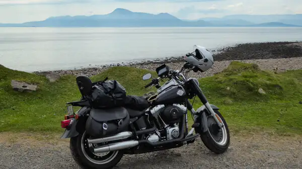
The Western Way Mayo
And there is another hiking highlight in County Mayo: The Western Way Mayo is a 127km long marked long-distance trail from Ballycastle in North Mayo to Leenane on Killary Fjord – or vice versa, because you can walk it in both directions.
On the northern section, it runs through the Wild Nephin National Park.
In the south, it joins the Western Way Connemara.
This is one of the loneliest trails Ireland has to offer and leads mainly on forest tracks through forests and mountains and along the shores of Clew Bay.
As always with these long-distance trails, you can walk only parts of it and still benefit from the great route on marked paths.
Find maps here: http://maps.toughsoles.ie/dist-maps/latest/Western%20Way%20%28Mayo%29.pdf.
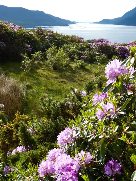
The Western Way Galway
From Leenane on Killary Fjord, the Western Way Galway stretches 55km via Maum, and the north shore of Lough Corrib to Oughterard.
You walk through rocky hills in complete solitude. The mountains of Connemara will captivate you! The more spectacular section is probably in the northern part of the route, which you can also discover on shorter walks.
Find maps here: http://maps.toughsoles.ie/dist-maps/latest/Western%20Way%20%28Galway%29.pdf.
The Cliffs of Slieve League
These cliffs are even higher than the Cliffs of Moher – yet far fewer tourists come here. This may be due to the somewhat remote location in the northwest of the island, or because there is less infrastructure there to accommodate busloads of tourists.
Whatever the case, this is perfect for hiking enthusiasts, because it means the place is not overcrowded! At Bunglass Point near Teelin you can admire the high cliffs and beautiful coastline. There is a small car park below, from where you can walk up a steep hill until you reach the viewpoint, or you can use the second car park, directly at Bunglass Point.
Probably the most popular walk is the cliff path, uphill from Bunglass Point to the ridge of Slieve Leagues and back down via an old pilgrims’ path. The walk is about 9km and leads back to the car park. It is sometimes steep and a little difficult to walk and therefore more suitable for advanced walkers.
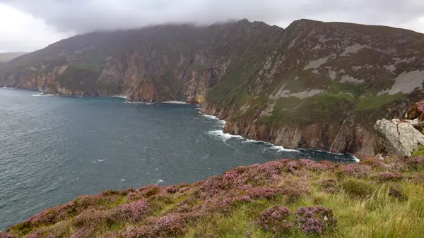
A good and easier alternative is the pilgrimage trail from the Cultural Centre of Slieve League in Teelin to the ruins on Slieve League and back. This is about 6km long, offers beautiful walking and is easy to walk.
See: https://www.slieveleague.com/.
The Sli Cholmcille
This long-distance trail is a loop trail, i.e. a circular route of 65km. It stretches from Ardara to Glencolumbcille and back to the starting point.
It consists partly of easy to walk paths on quiet minor roads and tracks, but also has steeper sections over the mountains and some stretches through bog.
Bog is not dangerous, but it can get very wet as the ground retains rainwater – waterproof walking boots are recommended.
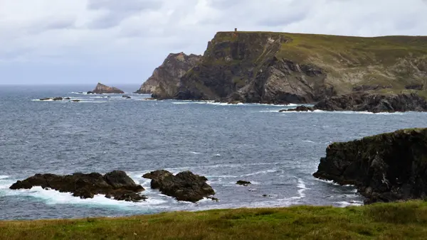
Glencolumcille is a village in a breathtakingly beautiful landscape, nestled between rocky mountains, cliffs and sandy beaches. You can also start your day trip here along the Sli Cholmcille.
Find maps here: http://maps.toughsoles.ie/dist-maps/latest/Sli%20Dhun%20na%20nGall%20-%20Sli%20Cholmcille.pdf.
The Bluestacks Way
This long-distance trail runs from Donegal, via Glenties to Ardara. Depending on the route you choose, it’s about 50-65km. As always, you can also do part of it as a day walk.
The route consists mainly of very small country roads, forest tracks, paths across meadows and pastures and some bend crossings. It reveals wonderful views of the mountain landscape and is rather easy to walk.
Find maps here: http://maps.toughsoles.ie/dist-maps/latest/Bluestacks%20Way.pdf.
The Sli an Eragail
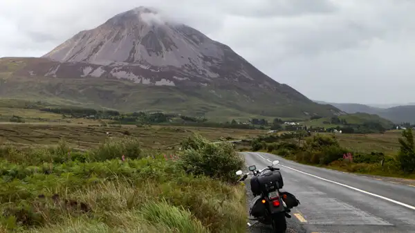
This long-distance walk is a loop trail, i.e. a circular route 77km long. It runs from Falcarragh to Mount Errigal past Gweedore and curves back to Falcarragh.
Mount Errigal is a rocky sugarloaf-shaped mountain that stands out very picturesquely from the surrounding area.
The trail combines gorgeous coastal stretches with bog and mountains. There is a high proportion of road and some soft paths and gravelled forest tracks.
Overall, the trail is rather easy to run, and if you are in the area, you can also do a coastal section or a mountain section of it as a day trip.
Fin maps here: http://maps.toughsoles.ie/dist-maps/latest/Sli%20Dhun%20na%20nGall%20-%20Sli%20An%20Earagail.pdf.
Conclusion
The north-west of Ireland is a diverse and rugged place. If you love the north, this is the place to be and you won’t mind the occasional drizzle. On the other hand, the most beautiful areas are not overrun by tourists and you have many of the most beautiful paths almost to yourself!
What more could you want? I wish you great hikes in Ireland’s northwest!
More interesting articles for you
THE MOST BEAUTIFUL HIKES IN THE SOUTHWEST OF IRELAND
THE MOST BEAUTIFUL HIKES IN THE INLAND OF IRELAND
EQUIPMENT TIPS FOR SHORT DAY WALKS IN IRELAND
22 TIPS FOR YOUR HIKING VACATION IN IRELAND
Photo credits cover photo: Meadows in Connemara, photo by Ulrich Knüppel-Gertberg (www.irland-insider.de, www.ireland-insider.com)