In this episode we leave the hustle and bustle and traffic of Galway city behind and follow the coast southwards…
Page Contents (click line to jump the text)
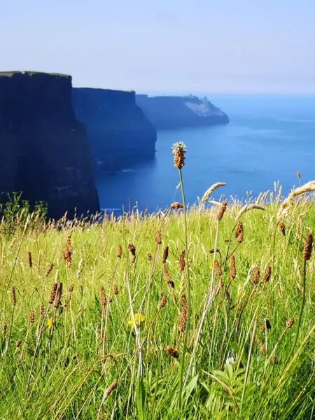
The Burren
Via Oranmore we head to Dunguaire Castle near Kinvara. The small castle is situated on a rock off the coast.
At high tide, the small island can only be reached via the main gate, but at low tide the rock is almost dry. You can visit the castle and there are also guided tours inside.
Following the N67, you reach New Quay and then Ballyvaughan. On your left you can already see the barren rocky peaks of the Burren.
The Burren is a protected karst landscape with unique fauna and flora. Numerous rare animals and plants live here in the small crevices that water has eroded into the rock over thousands of years.
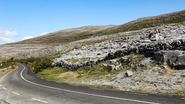
In Ballyvaughan, you can continue along the R477 coastal road and experience a small but beautiful road high above the sea with fantastic views of Galway Bay. The route then continues via Fanore to Doolin. The coastal road is also really picturesque further on.
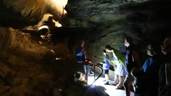
Alternatively, you can drive over the mountains: In Ballyvaughan, follow the N67 a little further and then turn left onto the smaller R480. A little further on you will come to Ailwee Cave. The guided tour takes just over an hour and the cave system with its impressive stalagmites and stalactites is absolutely worth seeing.
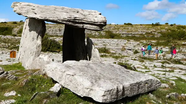
The small road curves up the mountain. Behind the crest, there is a small car park on the left. There you will find the Poulnabrone Dolmen, one of the best preserved dolmens in Ireland.
Some signs inform about the find and the time about 5000 years ago when prehistoric peoples used dolmens as places of worship. Experts are still speculating about the purpose at that time, but we don’t mind – it’s just a nice photo stop!
Via Lisdoonvarna we return to the coast and continue to Doolin. Passing Doonagore Castle, you rejoin the R478, which you follow southwards.
The Cliffs of Moher
Follow the R478 coast road and after a few kilometres you will reach the car park of the Cliffs of Moher Visitor Centre. The car parks are probably already full of coaches, as the Cliffs of Moher are one of the most important sights in Ireland.
But don’t be put off, the Cliffs are really worth seeing and the area is extensive. So the visitors are well distributed.
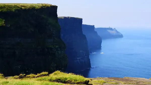
The cliffs stretch for 14 kilometres. They rise up to 120 metres above the Atlantic Ocean at the highest point!
Millions of seabirds use the cliffs as breeding grounds and fishing grounds. Only 100 years ago, the Irish used to lower themselves down the cliffs on long ropes to collect the eggs – a dangerous job!

Today the cliffs are protected. An exhibition in the visitor centre explains the fauna and flora and shows photos and finds. If you are less interested, you can take a lunch break directly in the restaurant.
There is a visitor path along the edge of the cliff and at the top of the highest point you come to O`Briens Tower, a beautiful observation tower.
Spanish Point and Loop Head
The further course of the coast also offers highlights time and again: At Spanish Point, numerous ships of the Spanish Armada sank in a storm in 1588. At the time, Spain was at war with England, which ruled Ireland at the time.
The village of Kilkee has a beautiful beach promenade and from there the small coastal road leads directly along the cliff edge.
The Kilkee Cliffs are also very beautiful, as are the Bridges of Ross a little further on: parts of the cliff have been washed free by the sea and hollowed out, naturally forming bridges.
At the southernmost end of the headland is the Loophead Lighthouse in a truly spectacular location.

Bunratty and Limerick
Inland, you follow the mouth of the Shannon. Either take the ferry to Trabert at Kilimer, or go via Bunratty and Limerick, where you can cross the bridge to the south.
Bunratty is a nice little place to stay overnight. The main attraction is the magnificent Bunratty Castle, which has also been used as a film location.

Bunratty was once a trading hub for the Vikings, who sailed their longboats along the coasts and up the rivers – including the Shannon, which at 360 kilometres long is the longest and most important river in Ireland. Where the Vikings traded, there was money.
Where there was money, settlements and fortifications followed and so, little by little, real cities developed – such as Dublin, Wexford, Waterford and also Limerick. Limerick is a city with everything that goes with it and of course it also has a castle – the great King John’s Castle lies directly on the Shannon.
Conclusion
South of the Shannon, the peninsulas of the south-west beckon – surely one of the most beautiful regions of the Wild Atlantic Way! But more about that in the next episode….
More interesting articles for you
IRELANDS WILD ATLANTIC WAY – PART 7 – DINGLE PENINSULA AND THE RING OF KERRY
IRELANDS WILD ATLANTIC WAY – PART 8 – THE BEARA PENINSULA
IRELAND’S WILD ATLANTIC WAY – PART 1 – AN INTRODUCTION TO THE WORLD’S LONGEST COASTAL ROAD
THE MOST BEAUTIFUL CASTLES AND PALACES ON THE IRISH ISLAND – 35 TIPS FOR YOUR ROUND TRIP
Photo credits cover photo: O´Brien´s Tower on the Cliffs of Moher, photo by Ulrich Knüppel-Gertberg (www.irland-insider.de, www.ireland-insider.com)