You may have heard of the Ring of Kerry – but did you know that the mountains within the Ring are even more impressive than the coastal road? These are the mountains of Kerry with Killarney National Park…
Page Contents (click line to jump the text)
Intro
Iveragh is the name of the peninsula in the south-west of Ireland. It is just one of several peninsulas that stretch out into the Atlantic Ocean.
To the north of Iveragh is the Dingle Peninsula and to the south the Beara Peninsula. To the south are Sheep’s Head, Mizen Head and the Baltimore Peninsula.
But let’s get back to Iveragh: most non-Irish people have probably never heard the name. But have you ever heard of the Ring of Kerry? That’s the coastal road that runs around the Iveragh Peninsula.
At the top are the Kerry Cliffs. The Ring of Kerry is heavily promoted for tourism and the name “Ring of Kerry” alone is great, isn’t it (“One ring to rule them all” – Lord of the Rings…).
Incidentally, the county is called Kerry, hence the name. And yes, Kerry Gold Butter also comes from here.
Inland lies the small town of Killarney. It’s a small town in winter, but in summer it’s a hive of activity – or rather tourism. Killarney is a popular holiday destination and offers plenty of accommodation, restaurants and bars. There are also plenty of activities that you can do from Killarney. But I might write a separate article about that.
In the centre of the peninsula lie the mountains of Kerry and in their midst the Killarney National Park. Here you will find the Mac Gillycuddy’s Reeks, the highest mountain range in Ireland with several rugged peaks over 1000 metres high. I know that doesn’t sound high to Alpine people, but the mountains here are rocky, rugged and picturesquely beautiful!
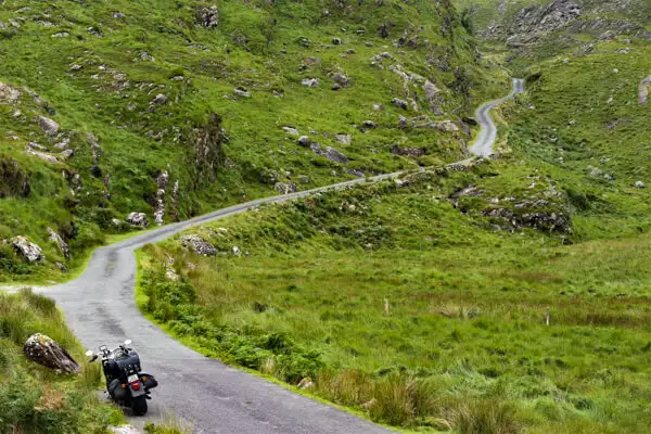
How do I know that? My family and I live in Ireland (second home) and we have visited the mountains of Kerry and the Ring of Kerry several times – by car, by motorbike and have also hiked here. Incidentally, this is probably the most beautiful way to explore the mountains of Kerry.
But let’s drive around the coastal road first – virtually, of course:
Ring of Kerry and the Kerry Cliffs
The Ring of Kerry starts and ends in Killarney. But if you’re travelling the coast from south to north, you may have spent the night in Kenmare. This is a lively coastal town in the eponymous Kenmare Bay in the south of the Iveragh Peninsula. And you can also start here:
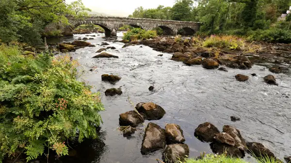
The Ring of Kerry always runs along the coast, from Kenmare via Blackwater Bridge to Sneem. On this route, you will initially see lots of trees and little water, with views of the sea only opening up further west.
The alternative is to drive up the mountain from Kenmare to Molls Gap and then take the beautiful mountain road to Sneem. This is also a good option if you have spent the night in Killarney.
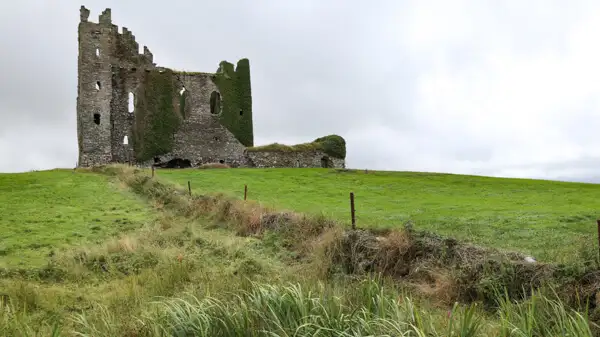
From Sneem, the route continues via Caherdaniel to Kenneigh. Before Caherdaniel is Castlecove and above Castlecove you will find the Staigue Stone Fort, a ring fort from around 300-400 BC (another ring).
At Kenneigh you should leave the N70 and follow the small coastal road R567 and R566 to the Kerry Cliffs. On the way there you will pass Reenroe Beach, a beautiful sandy beach. The Kerry Cliffs are a beautiful sight and well worth a visit.
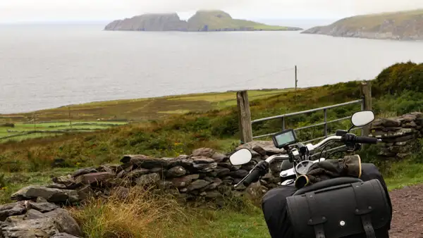
A little further on is the small harbour town of Portmagee. Here you will find boat trips to the offshore islands of Skellig Michael and Puffin Ireland. Thousands of seabirds live and breed there. Puffins are the pretty little puffins with their colourful beaks.

Skellig means pointed rock or rock needle. Steep steps lead you up the mountain on Skellig Micheal to Fionan’s Monastery or Monastery of Skellig Michael. Here, on this rock in the sea, monks built a small monastery in the early Middle Ages. To build it, they used what nature had to offer: stones! The monks’ modest huts are igloo-shaped stone huts.
This picturesque setting became famous worldwide as the retreat of the ageing Like Skywalker in the Star Wars films “The Force Awakens” and “The Last Jedi”.
You can find out more about the Skelligs, the monks and the seabirds at the Skellig Experience Visitor Centre when you drive over to Valentia Island from Portmagee.
Valentia Island is a small island off the coast. A bridge leads from Portmagee to the island, and at the eastern end you can take a ferry back to the mainland. There are a few beautiful viewpoints in the north of Valentia Island: The Geokaun Mountains and Cliffs, the Tetrapod Footprints and the Valentia Island Lighthouse.
Via Caherciveen, the route continues along the coast via Rossbeigh Strand and Killorglin back to Killarney, where the ring closes.
There is a theory that it is better to drive the Ring of Kerry clockwise by car (or motorbike), as I have just described, because coaches are only allowed to drive anti-clockwise. You’re also travelling on the left-hand side and it makes sense to see the sea right next to you (on the left).
But if that doesn’t fit into your route planning, don’t let it drive you crazy, the Ring of Kerry is beautiful in both directions.
Killarney National Park and the mountains of Kerry
From the sea to the mountains – how nice when you can see both on one tour!
Killarney National Park lies to the west and south of Killarney town. The Gap of Dunloe and Mac Gillycuddy’s Reeks lie a little further west of the national park. It extends into the urban area, as Ross Island with Ross Castle and Muckross House are also located within the park.
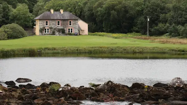
And here, right outside the gates of the small town, you can already see an incredibly beautiful landscape, because when you look from Muckross House or Ross Castle across Lough Leanne to the mountains beyond, you are already deeply moved and impressed – I promise!
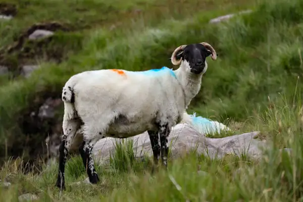
If you’re lucky, you’ll see red deer in the mountains – this is the last free-ranging population of Irish red deer on the island! You’ll also see deer in Phoenix Park in Dublin, but these are fallow deer and sika deer can be seen in the Wicklow Mountains and other low mountain ranges. There are also many wild goats in the mountains – descendants of feral domestic goats.
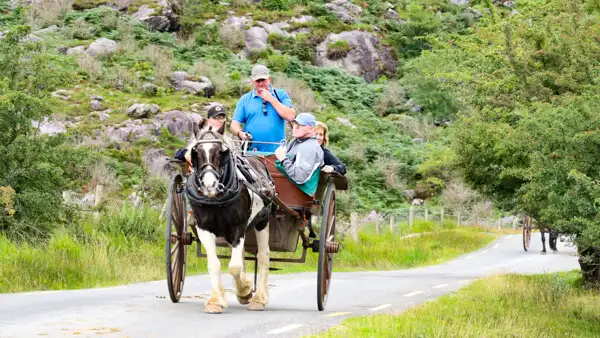
You can take a horse-drawn carriage ride around Lough Leanne to Upper Lake Killarney, or take a motorboat ride or even a guided kayak tour on the lake. You can hire a bike or just go for a walk. Either way – it’s just beautiful!
Another nice excursion is the short hike to Torc Waterfall, not far from Muckross House.
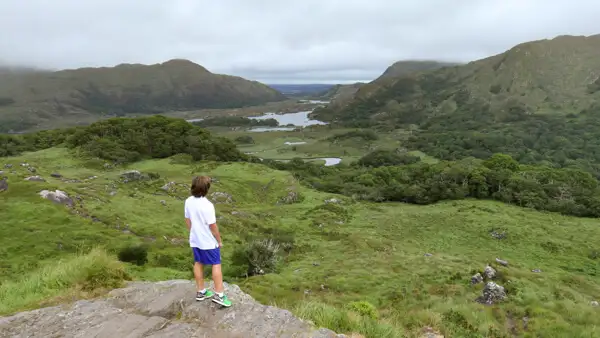
A little further towards Molls Gap you will find the Ladie’s View lookout point. From here you can admire Upper Lake Killarney and look far into the mountains of the national park. The viewpoint was named after Queen Victoria of England, who enjoyed the view here in 1861 and was visibly taken with it.
You can find more information about Killarney National Park and its offerings and opportunities here: https://www.nationalparks.ie/killarney/.
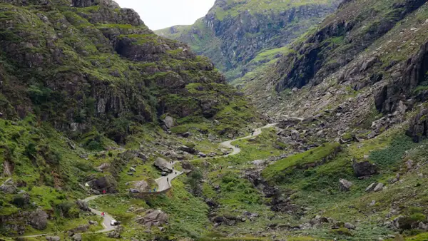
Gap of Dunloe
The Gap of Dunloe is a breathtakingly beautiful gorge in the mountains of Kerry. The village of Dunloe lies just west of Killarney.
Here you can leave your car and walk up the small single track road past the lakes to the Gap, or hire a coach and take the tour.
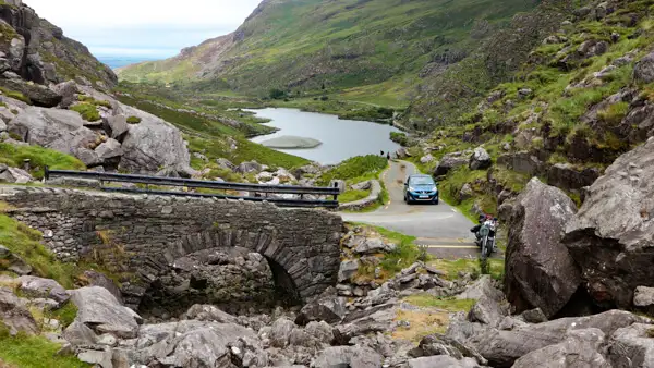
I travelled the route by motorbike and it wasn’t always easy because of the carriages on the narrow road. If you have hired a small car, you can also drive up by car, but definitely not in a motorhome!!!
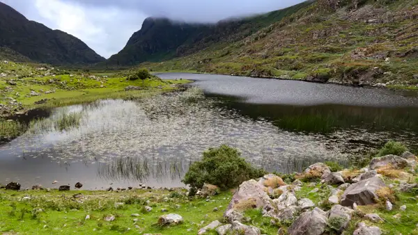
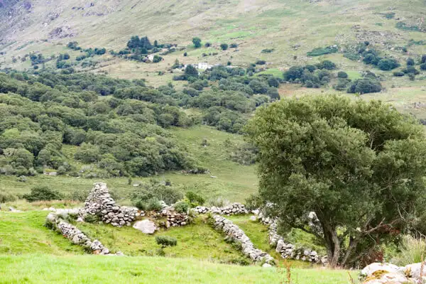
On the other side of the Gap of Dunloe you come to the Black Valley. To your right are the mountains of the Mac Gillycuddy’s Reeks and in front of you Lough Gummeenduff. Here you are in the middle of the most beautiful hiking trails. Continue past the Black Valley Hostel. A few bends further on you come to Molls Gap again.
Beautiful mountain roads and passes in the mountains of Kerry
If you only have one day for the Ring and the mountains, you can do half the Ring and then take the small road at Caherciveen towards Ballaghisheen Pass and Glencar. You can also do this from Spunkane if that suits your plans better. You cross the mountains of Kerry in a west-east direction.
Alternatively, you can cross the mountains of the peninsula in a north-south direction, from Caragh Bridge via Glencar and the Ballaghbeama Gap to Garha South.
In both cases, you’ll come via Glencar, which should be easy to find on the map. Again, a warning: the roads are single carriageway with a few passing places and therefore not suitable for motorhomes. But for everyone else, the routes are beautiful!
What else you can see in the area
Ross Castle is located on Lough Leane and is one of the most important sights in Killarney. See: https://heritageireland.ie/visit/places-to-visit/ross-castle/.
Muckross House is also on Lough Leane and is a beautiful manor house with a park. I was there, the location on the lake is a dream! There is also an open-air museum about traditional Irish farming. See https://www.muckross-house.ie/.
The Dingle Peninsula is a beautiful peninsula in the north of Iveragh. Particularly recommended are Inch Beach on the south coast, the Slea Head Drive around the tip, the Conor Pass over the mountains and the beaches on the north coast.
The Beara Peninsula south of Iveragh is also a dream. You can also drive the south coast in a motorhome, but I would only drive the small roads on the north coast and the Healy Pass in a car or on a motorbike. At the top, you can take a cable car – the only one in Ireland – to Dursey Island.
Mizen Head is also a very beautiful peninsula south of Beara with a very nice old radio station. You can find my article about it here: https://ireland-insider.com/mizen-head-signal-station-first-and-last-contact-with-europe/.
Conclusion
There are several scenic peninsulas in the south-west of Ireland. And there are also coastal roads that can easily compete with the Ring of Kerry.
But the combination with the Kerry Mountains and the Killarney National Park in the centre, as well as the town of Killarney and its attractions, make the Ring of Kerry and the Iveragh Peninsula unique!
Is the Ring of Kerry a tourist cliché? Yes! Should you still include it in your tour? Yes – definitely!
With this in mind, I hope you enjoy exploring the Ring of Kerry and the mountains of Kerry!
More interesting articles for you
THE ANCIENT STONE-HOUSES OF DINGLE
MIZEN HEAD SIGNAL STATION – FIRST AND LAST CONTACT WITH EUROPE
THE KERRY WAY
THE DINGLE WAY
THE BEARA WAY
Picture credits cover picture: At the Gap of Dunloe, photo: Ulrich Knüppel-Gertberg (www.irland-insider.de, www.ireland-insider.com)